Geospatial Data Annotation for Machine Learning and AI

We know about the usage of geospatial data in maps and GPS from our daily lives. It can also be used in checking forecasts or planning urban settings. However, it has become even more evident with the application of AI tools across industries. With geospatial imagery, we leverage our predictions and scrutinize our analyses. AI tools help us perform better in a shorter period.
Apart from that, the geospatial data has been introduced only for good. There are several other benefits as well that are somehow helping to shape the modern world. Also, learn about Integrating Cloud Computing into AI Softwares by reading this article.
Thus, let’s see what’s behind the scenes. How do we use geospatial data before passing it to AI model training?
From Geospatial Sources to ML Performance
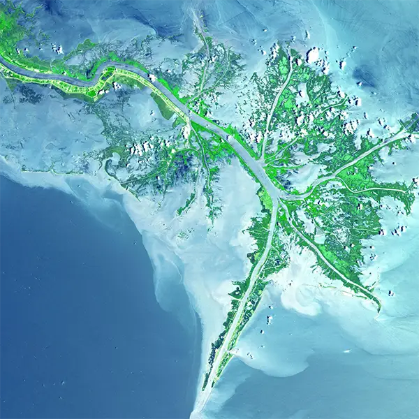
We use geospatial images, it is far easier to detect objects and run predictive analyses. The following types of geospatial data usually make the basis for further AI model building:
- Satellite imagery: In high resolution, these images capture space and land from space. That data is further utilized for various applications including land classification and environment monitoring. They help to identify objects such as buildings and vehicles.
- Aerial imagery: This type of imagery provides detailed views by capturing it from aircraft or drones flying at lower altitudes. The most frequent applications are in urban planning, infrastructure, and mapping disaster response efforts. Geospatial data annotation works with these two types the most.
- LiDAR data (Light Detection and Ranging): LiDAR produces 3D point cloud data that precisely maps the elevation and position of objects on the Earth’s surface. It is commonly used for creating digital elevation models (DEMs), for terrain and waters analysis. Moreover, this tech is also getting integrated into modern high-tech cars.
- Vector data: This form is known for depicting geographic features like roads, rivers, and administrative boundaries. It is necessary for tasks such as optimizing routing or performing demographic studies.
The next step after the record collection is labeling it through data annotation tools.
Importance of Data Annotation for Machine Learning Model
It does not matter if you opt for a manual or automated type of annotation, this step is necessary in ML data preparation. Employing geospatial tools in AI offers numerous advantages. They greatly enhance the capabilities of these technologies. Here are some benefits:
- Superior accuracy and precision: By carefully organizing geospatial data, AI models gain access to precise information. High-quality inputs significantly decrease the chance of errors in AI outputs. As a result, we benefit from less dependable outcomes.
- Enhanced decision-making: Annotated yields comprehensive insights for the final decision-making. With well-structured data, AI models can forecast future trends and changes. This in turn contributes to intelligent decision-making and strategic planning.
- Improved automation: AI models trained on detailed geospatial data can automate more complex tasks. We use it for classification, disaster response, and infrastructure monitoring. These automated systems can manage large-scale data and operations more efficiently than manual processes.
- Cost efficiency: By minimizing the need for manual data processing, analyzed data helps organizations optimize resources. As a result, businesses save much on costs. Automation reduces operational expenses and decreases the need for manual efforts. As a result, processing time goes down.
- Positive environmental and social impacts: In agriculture, for example, data gone through an AI filtering tool supports precision farming. Consequently, it promotes better resource management and sustainable practices. It also improves disaster prediction and response, reducing damage and aiding in recovery efforts.
Closer Look at the Annotation Process
From data collection to model validation, data management helps us to make the annotation process consistent. Annotation involves several major steps to ensure that the data is accurate. Everything starts with data collection, where you identify the sources of geospatial data. These are usually satellites, aerial imagery from drones or planes, LiDAR systems, GIS data, and GPS devices. You often collect the raw information from satellite images, drone footage, LiDAR point clouds, and other sources.
In data preprocessing, you typically remove any noise from the raw data. This includes correcting errors or filling in missing values, whatever the geospatial tool you use. Now, this is the stage where you also work with georeferencing. During the annotation stage, you entrust the process to human annotators. They identify and mark objects, boundaries, or features of interest, depending on your task. After the annotation, testing and validation take place, with further improvement for ML training.
Leveraging Geospatial Data Across Industries
Deep learning algorithms fueled by precise annotation and data standardization make wonders. They leverage the performance of AI tools and move analytics and predictions to the next level. Who benefits from geospatial imagery the most? Following are some major industries that are its major clients:
- Environmental monitoring: By tracking the environment and wildlife, climate, and nature, we can forecast changes and disasters. We see where human intervention is significant and more protection is needed. This allows us to better manage natural resources and our environment.
- Agriculture: With AI tools the industry players predict harvesting, detect any crop illnesses, and monitor crop growth. This helps us with more sustainable crop management and better use of resources.
- Urban planning: City planning is a tricky yet significant stage from the due diligence. As part of smart city planning, geospatial AI tools guide us in managing urban space and planning infrastructure.
- Transportation: Managing the network with traffic and incoming/outgoing traffic can be much hectic if done manually. Thus, monitoring the fleet and managing traffic becomes easier with AI tools. Besides, geospatial imagery helps with delivery planning and reducing delivery costs.
- Energy sector: We can manage energy grids, including future installations. We also optimize the placement of renewable energy sources.
Integrating geospatial data with AI allows various sectors to achieve remarkable improvements. They can also increase their operational activity. They leverage sustainability and overall performance.
Final Thoughts
Geospatial data annotation serves as a vital connection. It links the geospatial information and the transformative power of AI. Through precise labeling of geospatial data, AI models can extract meaningful insights.
The benefits are evident: improved AI model accuracy and increased analysis efficiency. This is not to mention the innovative applications across various sectors.
As the demand for geospatial AI solutions rises, the role of data annotation becomes even more significant. It leaves a deep influence on the ML model’s performance so that their efforts lay the foundation for a future.